Radio stereo with USB/Bluetooth and remote control.
€157.14
€224.48
-30%

Discover a new navigation and fishing experience with DISCOVER M-EM-Y201 cartography, compatible with Lowrance, B&G and Simrad instruments. Designed to offer the highest level of detail, this map covers the Tyrrhenian Coast and Islands, providing a clear and accurate view of the seabed.
The vector charts include depths, contours, sounding points, nautical aids (NavAids), light sectors, wrecks, obstacles and much more. Each element is designed to offer safer navigation and more effective fishing. You can set custom safety depths and easily locate underwater pinnacles, canyons and ledges, which are real hotspots for coastal game.
Support is guaranteed on SD or MSD cards up to 32 GB.
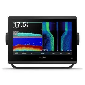
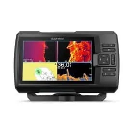
The new Garmin GPSMAP series has higher resolution and faster processor performance. The 9" touchscreen offers an optimized user interface and can easily be integrated into the Garmin marine system. CHIRP sonar, ClearVü, and SideVü provide a detailed view of fish and underwater structure. The Garmin GPSMAP series also offers integrated autopilot control, compatibility with Garmin radar, and built-in wireless connectivity. The Quickdraw Contours feature allows for real-time creation of custom maps.
Pick a color, then click OK