Radio stereo with USB/Bluetooth and remote control.
€157.14
€224.48
-30%

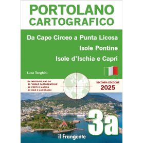
This pilot book describes, in 50 charts, the coastline of the central Tyrrhenian Sea from Capo Circeo to Punta Licosa, including the islands off the coast: the Pontine Islands (Ponza, Zannone, Palmarola), Ventotene and Santo Stefano, Ischia, Capri and Procida.
The introduction includes general information on the navigation area, distances and main routes, a list of useful nautical charts and general meteorological information.
The volume is divided into two main areas, each of which features a quick guide to the main ports and marinas, along with details of the services available.
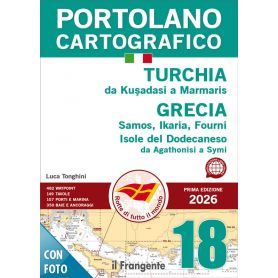
This pilot book describes, in 149 charts, the coastline of Turkey from Kuşadasi to Marmaris and the Greek islands off the coast, including Samos, Ikaria, Fourni and the Dodecanese islands as far as Symi.
The introduction includes general information on the sailing area, distances and main routes, a list of useful nautical charts and general meteorological information.
The volume is divided into five main areas, each of which features a quick guide to the main ports and marinas, along with details of the services available.
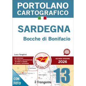
This pilot book describes the coasts of Sardinia, including all the surrounding islands, as well as the Strait of Bonifacio.
The volume consists of 122 chart plates illustrating harbor plans, landing places, and anchorages around this large island.
The introduction includes general notes on the sailing area, distances and main routes, a list of the required nautical charts, and general meteorological information.
The volume is divided into five macro areas, each of which begins with a quick-reference guide listing the main ports and marinas of Sardinia along with their services.
This pilot book describes the Mediterranean coast of France, from the Italian–French border to the French–Spanish border, and includes the so-called Riviera, the Côte d’Azur, Provence, and the Languedoc-Roussillon region.
The volume is divided into five macro areas and consists of 133 chart plates that illustrate, in detail, harbor plans, landing places, and anchorages.
The introduction includes general information, distances, main routes, nautical charts of the sailing area, and meteorological guidance.
At the beginning of each area, a quick-reference guide allows consultation of the main ports and marinas along with their services.
This pilot describes the coasts of Corsica and Sardinia, including all the neighbouring islands, and the Strait of Bonifacio.
The volume comprises 171 charts illustrating harbour plans, landing places and anchorages on this large island.
The introduction includes general notes on the navigation area, distances and main routes, a list of the necessary nautical charts and general meteorological information.
The volume is divided into five main areas, each of which features a quick guide listing the main ports and marinas of the two islands along with their facilities
The main feature of this pilot book is its 225 charts, which provide detailed illustrations of all the ports, landing places and anchorages within the navigation area, which is divided into five macro-zones.
The introduction includes general information on the navigation area (regulations, services for recreational boating, entry formalities, marine protected areas, etc.), a chart showing distances and main routes, a list of traditional and digital charts, and general meteorological information. The quick reference guides for each macro-area are also very useful, listing the main ports and marinas and their respective services.
The main feature of this pilot book is its 210 charts, which illustrate all the ports, landing places and anchorages in the navigation area, presented in highly detailed plans that are easy to consult thanks to a wide range of pictograms. This volume describes the entire Spanish Mediterranean coast in six macro-zones, comprising the Costa Brava, Costa Dorada, Costa Azahar, Costa Blanca and Costa del Sol, stretching from Portbou on the Franco-Spanish border to Tarifa in the Strait of Gibraltar. The quick-reference guides at the start of each chapter list the main ports and marinas, along with their facilities and bays.
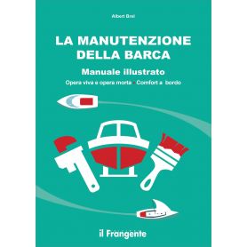
A boat requires regular maintenance if you wish to keep it in top condition and preserve its resale value. This richly illustrated manual is accessible to everyone. It describes every part of the boat and explains, step by step, everything you need to do to ensure it is well maintained and kept safe.
In 1977, Éric Tabarly asked Titouan Lamazou, who was sailing aboard the Pen Duick VI at the time, to illustrate the manual on manoeuvres that he had been writing for some time. The skipper and the crewman then set
to work, whilst sailing through the Marquesas, Tuamotu, Gambier and Austral Islands, all the way to Tahiti.
The result is this Guide to Manoeuvres, first published in France in 1978. A true compendium of the immense experience acquired by Éric Tabarly over a lifetime dedicated to sailing.
Titouan Lamazou’s illustrations enrich the text and bring life on board to life.
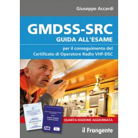
Following on from the training programme on the use of maritime radio communication systems outlined in the previous edition of the GMDSS-SRC Handbook: Guide to the Examination for Recreational Craft, this fourth edition also includes guidance on obtaining the Short Range Certificate in accordance with the RYA (Royal Yachting Association) standards in force in the United Kingdom, which can now also be obtained in Italy and is valid internationally. It is worth noting that, whilst in Italy the GMDSS certificate is compulsory only if a VHF-DSC radio is on board, in other countries this certificate is compulsory even if a VHF radio without DSC functionality is used.
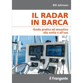
From the basics to more specific topics, this manual is intended as a practical and comprehensive guide for boaters using radar on their vessels.
The author clearly explains what radar is, outlines what it can and cannot do, and describes how to make simple adjustments to achieve an optimal image on the screen. This is followed by an in-depth look at the possible discrepancies and anomalies that may appear in the image, before moving on to the more complex features of a modern digital (raster) system. Finally, the key factors to consider when choosing and installing a radar system on board a boat are outlined.
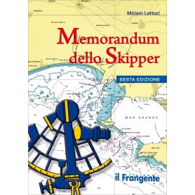
The Skipper’s Handbook remains a useful and practical guide for skippers to keep on board, allowing for quick reference to the most important topics and concepts for navigation, presented in 27 colour, laminated sheets printed on water-repellent material.
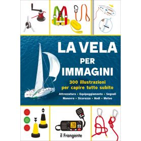
This illustrated guide provides the key to discovering and understanding the world of sailing in a simple and straightforward way.
You will learn to identify the parts of a sailing boat, in particular the different types of hull and keel, the rigging and sails, and to recognise the various types of boat and the main items of on-board equipment.
You will discover everything there is to know about safety equipment for different sailing areas, essential knots, navigation instruments, nautical charts, tides and the weather.
Not to mention basic sailing and motoring manoeuvres, buoys, lights and signals, rules of the road, the International Phonetic Alphabet, flags and pennants.
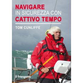
Bad weather is a constant threat that most of us hope to avoid and do our best to steer clear of, but even the most careful study of the weather forecast cannot completely rule out the possibility of encountering a storm. The aim of this short, easy-to-read book is to provide everyone, regardless of their sailing ambitions, with a solid grounding. In this way, whether we find ourselves facing force 6 gales along the coast or towering waves on the open sea, we will be fully aware of the options available to us to manage the situation safely.
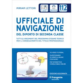
The manual provides a comprehensive coverage of all the topics in the Ministry’s examination syllabus, supported by a wealth of colour illustrations. Furthermore, this updated edition, which includes an interactive multimedia version, features an online assessment questionnaire – also available in audio format – making it ideal for studying anywhere and at any time.
The 112 video tutorials, accessible via QR code, are divided into two distinct sections: advanced content for users with practical experience and nautical knowledge, and basic content covering all the key theoretical concepts useful for beginners or as a revision aid for experienced users.
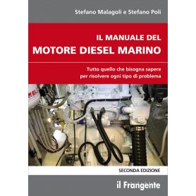
This manual, useful for both novice and experienced sailors, aims to provide a clear and comprehensive description of the inboard engine, covering all its components and how it works, to help skippers identify problems and resolve them effectively. It does so through a wealth of illustrations, diagrams and photographs that show, step by step, the various procedures to be followed during repairs. It also provides instructions for proper routine maintenance, such as keeping a logbook, and useful advice on regulations.
Metal corrosion on boats remains a little-known or poorly understood topic. Yet understanding and preventing corrosion is vital for the safety and integrity of the vessel.
This handbook, illustrated with numerous images, is designed for boaters and shipbuilders. The author clearly and comprehensively explains the different types of corrosion, describes the mechanisms involved, and explains how to prevent them and mitigate their effects. The second edition, revised and expanded, is enriched with a series of practical case studies illustrating the various ways in which corrosion
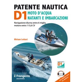
The manual fully covers the Ministry’s curriculum for the new D1 licence, commonly known as the ‘patentino’. This licence permits daytime navigation only within 6 miles of the coast on small craft, jet skis and motorboats with engines up to 85 kW (115.6 hp). It can be obtained from the age of 16 for vessels up to 10 metres in length; for candidates over 18, the limit is extended to 12 metres. The content is organised into 6 chapters.
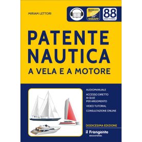
This manual is fully aligned with the Ministry’s curriculum for obtaining boat licences for waters within 12 miles of the coast and beyond. The text is accompanied by numerous illustrative images, which provide valuable support in memorising the extensive exam syllabus. This twelfth edition includes 88 video tutorials, accessible via QR codes, to better explain the more complex topics.
An Illustrated Guide for Beginners
This guide is designed for those approaching sailing or motorboating for the first time and wanting to feel confident and capable right from the start.
Simple and effective explanations, combined with very clear and practical illustrations, guide beginners step by step through the essential basics: how to move about on board, how to assist with manoeuvres, which terms to know and what to do in emergency situations.
Produced with the help of expert RYA instructors, this book provides the essential skills needed to tackle your first sailing experience without stress, whether as a trainee skipper, an active crew member, or simply to fully enjoy life on board.
This handbook contains the 50 questions from the official exam papers in force from 13 May 2022 at all examination centres – the Motor Vehicle Agency and the Maritime Authority – for the boat licence valid within 12 miles of the coast.
The first part is introductory for those approaching the subject for the first time and uses illustrations to introduce the five questions included in each exam question.
The exam questions cover the three official sectors of Chart 5/D of the Italian Navy Hydrographic Institute:
the horizontal NW sector, the vertical NW sector, and the SE sector.
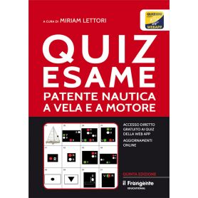
This handbook contains all the official quizzes – both basic and sailing-specific – organised by topic in line with the sequence of Miriam Lettori’s theory textbook *Sailing and Motorboat Licence*. This allows students to approach their studies in a logical and progressive manner, whilst being able to easily refer back to specific pages for further study and revision. This method is also invaluable for those using other theory textbooks, as it enables them to master the entire ministerial syllabus by following a rational and structured approach.
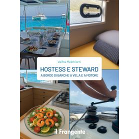
The ideal handbook for anyone wishing to pursue a career as a hostess or steward on sailing or motor yachts, whether privately owned or charter vessels.
The author offers practical advice covering all aspects of life on board: welcoming and assisting guests, preparing the boat, managing the galley, cleaning and maintaining the living areas, safety and first aid, and assisting with manoeuvres, to name but a few.
A practical guide that reveals the secrets of organisation and conduct to ensure you remain professional at all times and responsive to passengers’ varying habits and the preferences of different skippers, enabling you to tackle the small and large daily challenges with confidence.
The sea in winter can offer colours and experiences rarely found in other seasons. Sailing feels more intimate, and even areas that are usually very busy regain a sense of tranquillity and a slower pace, allowing you to appreciate your time on board all the more.
Of course, sailing out of season safely and enjoyably requires a few extra precautions compared to what you are used to in summer. The author covers all the aspects you need to consider before setting sail in winter: proper preparation of the boat, with particular attention to insulation and heating.
Pick a color, then click OK