Radio stereo with USB/Bluetooth and remote control.
€157.14
€224.48
-30%

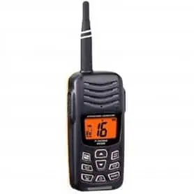
HX300E is a high-quality portable VHF radio with an extremely compact and durable design. Thanks to its automatic activation function of a flashing strobe light in case of falling into the sea, this radio is particularly suitable for those who spend a lot of time on a boat or in open water. Among its main features are programmable scanning, priority scanning, tri-clock and dual-watch function, a set of 10 preset channels, a powerful internal 600mW audio speaker, and an easy-to-manage menu. With the HX300E, you can enjoy clear and reliable transmission in every situation.
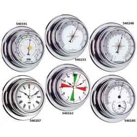
Series "PEGASUS 95" clock with mirror polished chrome-plated brass case.
Ø base 95 mm
Ø dial 70 mm
Height 45 mm
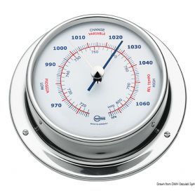
Barometer series "PEGASUS 95" with mirror polished chrome plated brass case.
Ø base 95 mm
Ø dial 70 mm
Height 45 mm
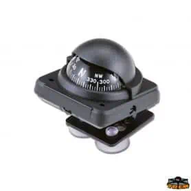
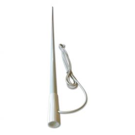
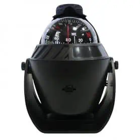
Compass with suction cup diameter 2 black colour. Manufactured in plastic material. Ultra-sensitive compensation system. Adjustable. Dimensions mm 55x55
This 2-inch diameter suction cup compass features a compact and functional design. Its white color gives it an elegant and discreet look that fits well in any environment.
Made of durable plastic, the compass is designed to last and withstand adverse environmental conditions. The suction cup, located at the base, ensures a secure attachment to smooth surfaces, making the compass ideal for use on boats, car dashboards, or other flat surfaces.
One of the distinctive features of this compass is the ultra-sensitive compensation system, which ensures precise and reliable direction reading even in the presence of external magnetic fields that could interfere.
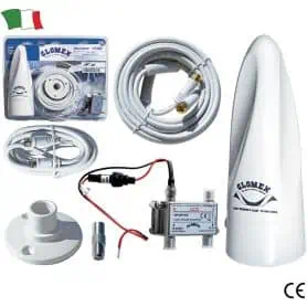
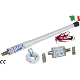
The Banten Spark DB-12C is a VHF antenna designed specifically for the marine sector, ideal for ensuring reliable, high-performance communications whilst at sea. Thanks to its high-gain collinear design and sturdy, polished outer shaft, it offers excellent transmission and reception quality, even in challenging marine conditions.
Technical specifications
Operating range: 156 – 162 MHz
VSWR: 1.3
Impedance: 50 Ohms
Gain: 6 dBi
Maximum supported power: 25 Watts
Polarisation: Vertical
Antenna length: 2.5 metres
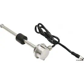
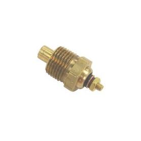
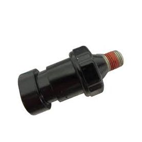
The SG Key brand water temperature bulb is a replacement part compatible with MerCruiser and Volvo Penta engines, offering a reliable solution for monitoring cooling system temperature. This sensor is designed to replace the original reference 97257A1 for MerCruiser and 3853787 for Volvo Penta, ensuring perfect compatibility and optimum performance.
The SG Key brand water temperature bulb is a replacement part compatible with MerCruiser engines, offering a reliable solution for monitoring cooling system temperature. This sensor is designed to replace the original reference 97258A1 for MerCruiser.
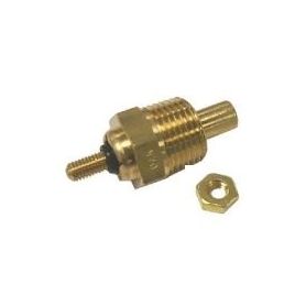
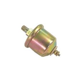
The SG Key brand oil pressure bulb is a high-quality, reliable component compatible with MerCruiser and Volvo Penta engines. Designed to replace the original reference 90806 or 815425T for MerCruiser and 872063 for Volvo, this bulb is the ideal choice for monitoring oil pressure and ensuring proper engine operation.
Thanks to its robust materials and precision construction, this component offers high strength and long service life, ensuring accurate oil pressure measurement. Essential for engine safety, this spare part keeps anomalies under control and prevents mechanical damage.
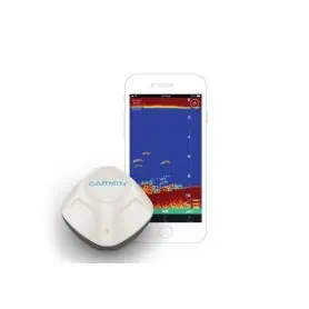
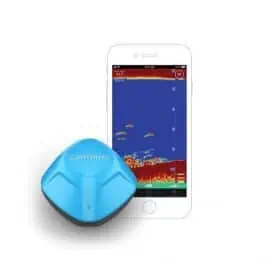
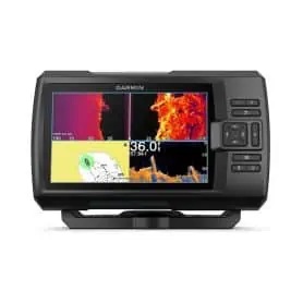
The STRIKER Vivid 5hp is a compact and intuitive fishfinder designed to provide clear and detailed images during every trip out on the water. Thanks to ClearVü technology, it guarantees extremely accurate visualisation of fish and structures under the boat, allowing you to easily distinguish between the seabed, obstacles and movements.
The colour display, with a resolution of 800 x 480 pixels, ensures sharp, well-defined images, while its compact size of 18.8 x 11.6 x 5.4 cm makes it ideal for small and medium-sized boats, without compromising on readability. The transducer-free version offers maximum configuration freedom, allowing you to combine it with the sensor that best suits your needs.
Pick a color, then click OK