Radio stereo with USB/Bluetooth and remote control.
€157.14
€224.48
-30%

With Garmin's NMEA 2000 analogue engine pitch/axis adapter on board your boat, you can upgrade your old gauges with the analogue-to-digital transition. The easy-to-install adapter takes the data generated by traditional analogue gauges and converts it into an NMEA 2000 signal so you can create or expand your network without replacing all the equipment on your boat.With Garmin's GET 10 adapter, you can convert the analogue information provided by the engine inclination sensor (not included) on your boat to the NMEA 2000 network. The GET 10 adapter allows you to observe engine inclination information on compatible Garmin display devices connected to the NMEA 2000 network.
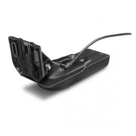
The GT52HW-TM transducer is perfect for those who want an excellent traditional CHIRP fishfinder and a CHIRP ClearVü and CHIRP SideVü fishfinder. This transom-mounted transducer clearly and crisply displays fish arches with outstanding target separation and clear definition of structure below and to the side of the vessel.
The 12-pin transducer includes a conventional broadband CHIRP echosounder (150-240 kHz) and a power rating of 250 W. The CHIRP ClearVü and CHIRP SideVü (455/800 kHz) elements have a power classification of 500 W each (1,500 W total).
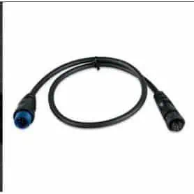
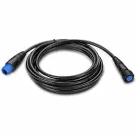
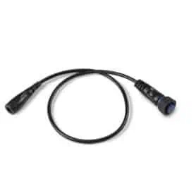
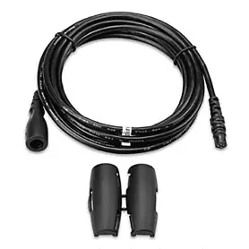
Connect a 4-pin transducer to an 8-pin sounder port on a marine device compatible with this adapter cable.
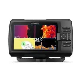
Echomap compatible.
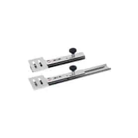
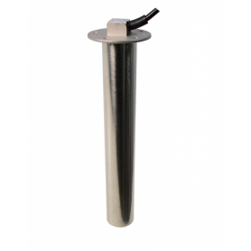
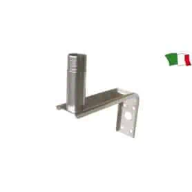
SONDA telescopic transducer holder, made of 2 mm thick AISI 316L stainless steel, profile width 60 mm, length 330 mm and 75x60 mm transducer base.
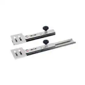
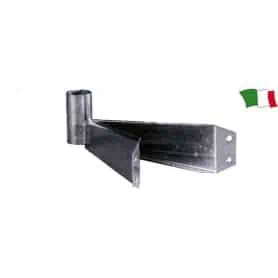
SONDA telescopic transducer holder, made of 2 mm thick AISI 316L stainless steel, profile width 60 mm and transducer base 75x60 mm, length 465 mm.
The Artica Series compass with an apparent Ø of 2 3/4” (70 mm) is a compact and reliable navigation instrument, designed to ensure precision and practicality on board. It features an internal semi-gimballed suspension, which keeps the card stable even in rough seas, and an integrated compensation system to correct possible magnetic deviations.
The standard 12 V lighting ensures perfect readability even during night navigation, while the anti-glare screen and the white graduated card with 5° intervals provide clear and accurate readings. The structure, in black flush-mount design, is both elegant and discreet, with overall dimensions of Ø131x106 mm, making it easy to install neatly on the dashboard or control console.
Steering angle sensor. Compatible with Osculati codes 27.320.17 / 27.321.17 / 27.322.17 and VDO instruments.
12/24V.
The VDO tubular sensor art. ES-224-011-0500 is a measuring device designed for continuous monitoring of the fuel level or other fluids inside tanks. It operates with a resistive signal between 0 and 180 Ohms, a standard widely used in VDO instruments, ensuring reliable readings and compatibility with numerous analogue indicators. Thanks to its length of 500 mm, the sensor is suitable for medium-depth tanks and stands out for its tubular structure, which ensures mechanical strength, stability over time and precision in level detection. It is designed for nautical applications.
The VDO tubular sensor art. ES-224-011-0650 is a component designed for continuous measurement of fuel or other fluid levels inside tanks. It operates with a resistive signal from 0 to 180 Ohms, an established standard that ensures full compatibility with VDO instruments and indicators, guaranteeing stable and reliable readings over time. Length 650 mm.
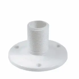
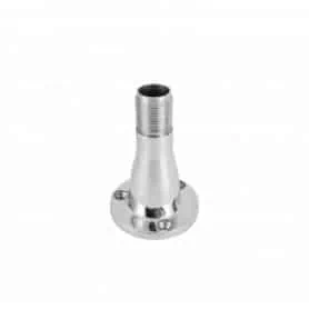
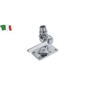
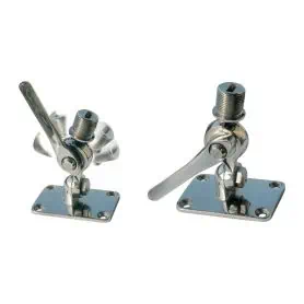
Made of AISI 316 stainless steel, this antenna base offers strength and durability even in harsh environmental conditions. Ideal for marine and outdoor applications, it guarantees stability and durability thanks to the quality of the material, which provides high protection against corrosion.
A reliable solution for those looking for a robust and high-performance mount for their antenna.
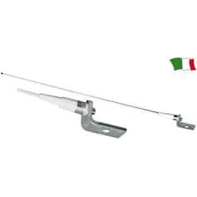
VHF ANTENNA
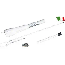
VHF fiberglass antenna, masthead installation. Supplied with 18 meters of RG-58 coaxial cable and a solderless connector that facilitates the replacement of existing antennas.
Length 120 cm
Frequency 156 - 162 MHz
Maximum power 25 Watt
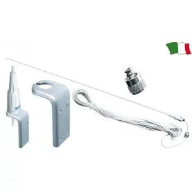
VHF fiberglass antenna, masthead installation.
Length 100 cm
Frequency 156 - 162 MHz
Maximum power 25 Watt
Pick a color, then click OK