Radio stereo with USB/Bluetooth and remote control.
€157.14
€224.48
-30%

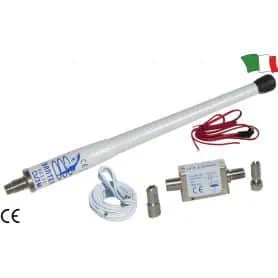
Fiberglass lacquered antenna for AM/FM radio.
Supplied with 6 meters of coaxial cable, nylon connector, and bushing.
Length 150cm
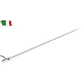
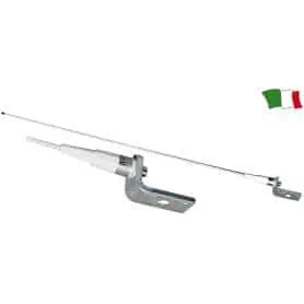
VHF fiberglass antenna, masthead installation. Supplied with 18 meters of RG-58 coaxial cable and a solderless connector that facilitates the replacement of existing antennas.
Length 120 cm
Frequency 156 - 162 MHz
Maximum power 25 Watt
VHF fiberglass antenna, masthead installation.
Length 100 cm
Frequency 156 - 162 MHz
Maximum power 25 Watt
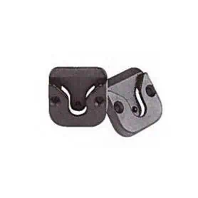
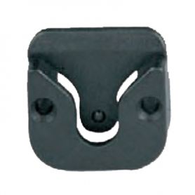
Universal VHF and CB microphone holder.
Length 35 mm, width 35 mm, height 8 mm.
Colour black.
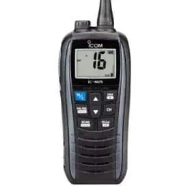
The IC-M25 is slim (30.5 mm) and lightweight (220 g). Additionally, the IC-M25 floats and, when in contact with water, flashes.
Universal microphone holder designed for VHF and CB devices. Made from durable material, it ensures a secure and stable mounting, keeping your microphone always within easy reach.
Compact and functional, it adapts easily to different installations, making it ideal for marine applications.
Dimensions:
35 × 35 × 8 mm
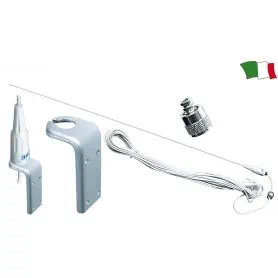
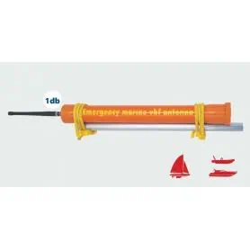
The RA 114 EMERGENCY VHF ANTENNA can be used if the main antenna breaks. It is supplied with a coaxial cable and PL259 connector.
Dimensions: 35 cm.
Steering angle sensor. Compatible with Osculati codes 27.320.17 / 27.321.17 / 27.322.17 and VDO instruments.
12/24V.
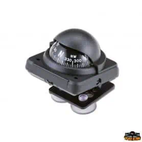
Compass with suction cup diameter 2 black colour. Manufactured in plastic material. Ultra-sensitive compensation system. Adjustable. Dimensions mm 55x55
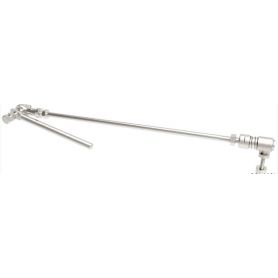
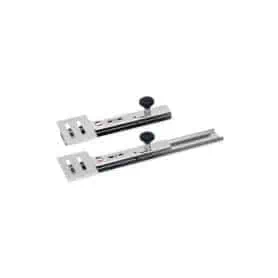
SONDA telescopic transducer holder, made of 2 mm thick AISI 316L stainless steel, profile width 60 mm, length 330 mm and 75x60 mm transducer base.
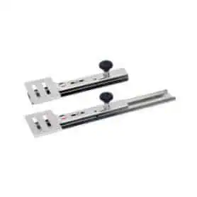
SONDA telescopic transducer holder, made of 2 mm thick AISI 316L stainless steel, profile width 60 mm and transducer base 75x60 mm, length 465 mm.
Pick a color, then click OK